River Survey using HydroFrog 25 USV with Edgetech 6205s2 sonar
2025-02-06
1. Demonstration Background
On 9 January 2025, Ocean Physics Technology Ltd. and Zhejiang Engineering Exploration and Design Institute Group Co., Ltd. organised a demonstration of the HydroFrog 25 USV carrying the Edgetech 6205s2 bathymetric side-scan sonar system in the waters of Nanguan River, Huangyan District, Taizhou City. The main purpose was to scan the underwater terrain and the distribution of obstacles to provide a reliable scientific basis for the next step of obstacle removal and navigation safety.
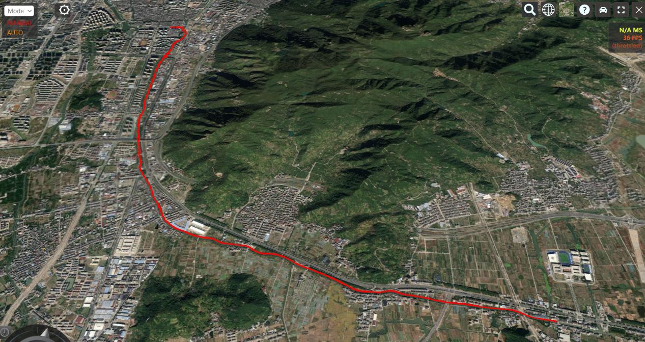
The demonstration area is located in Taizhou Huangyan District, from Xiyangzheng to Batouzha on Nanguan River, with a total length of about 8.7 km. The water depth in the area is 1-4 m, and the width is 10-30 m. To ensure data quality, the survey was taken once each way along the river.
2. System used during the demonstration
2.1 HydroFrog 25 USV
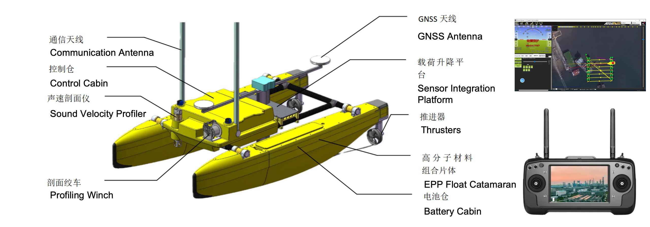
HydroFrog 25 is a multi-purpose unmanned vessel system developed and produced by OPT. 2.5 metres in length, HydroFrog 25 utilises a catamaran structure with stable rolling, and an open truss structure in the centre, which allows it to carry single-beam and multi-beam echosounder, sub-bottom profilers, ADCPs, multi-sensor instruments and other equipment to carry out different scenarios and tasks.
The HydroFrog 25 features replaceable and expandable IP68 rated battery packs, electric propulsion and a self-developed power management system for long operating time, safe and stable charging, and environmental friendliness. The main connections can be quickly setup and dismantled, allowing the vessel to be assembled, mission equipment installed and deployed by one or two people in minutes. It could be folded up in a small SUV for transport.
HydroFrog 25 is equipped with a self-developed sound velocity profiler winch, which can collect the sound velocity profile data of the target area via surface control software of the USV. We can also provide a full set of mobile USV LARS system, which is suitable for most challenging project areas. Survey project can never be so convenient.
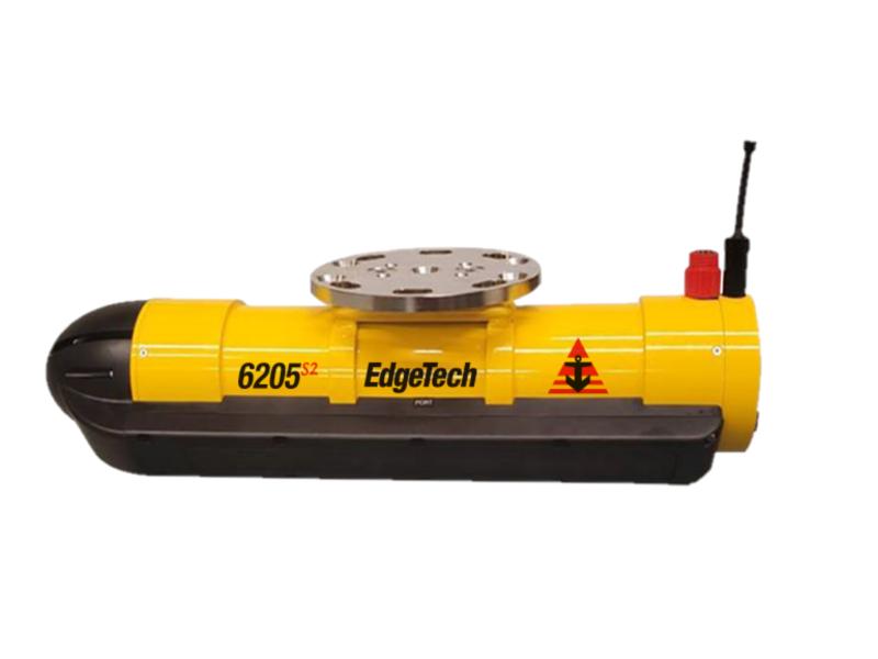
2.2 Edgetech 6205s2 Combined Bathymetry & Side Scan Sonar
The EdgeTech 6205s2 is our 4th generation fully integrated Wide Swath Bathymetry and Dual Frequency Side Scan Sonar System that produces real time, high resolution, side scan imagery and three-dimensional maps of the seafloor. The 6205s2 overcomes the limitations of Multi Beam Echo Sounders (MBES) and Interferometric (Phase Differencing) systems in shallow water by using EdgeTech’s unique Multi-Phase Echo Sounder (MPES) technology. This unique Hybrid approach utilizes multiple receive arrays and combines both Beamforming and Phase Differencing techniques to determine each sounding along the seafloor. With the integration of EdgeTech’s Full Spectrum® CHIRP technology, the 6205s2 exceeds IHO SP-44, NOAA, and USACE specifications for Feature Detection and Bathymetric Point Data Uncertainty.
EdgeTech’s MPES technology enables the 6205s2 to produce wider and cleaner swath (over 200º) than current technologies, resulting in superior coverage enabling faster and safer survey completion. At the same time, the 6205s2 rejects multipath effects, reverberation, and acoustic noise commonly encountered in wide swath high resolution environments.
Additionally, EdgeTech’s latest broadband Electronics and Modular Arrays are utilized in the 6205s2 resulting in a lightweight design, which is required for wide swath high resolution applications and survey platforms of opportunity. The standard configuration for the 6205s2 includes an integrated Sound Velocity sensor and optional integrated OEM Inertial Navigation System, and interfaces to all popular 3rd Party acquisition and processing software packages, as well as to standard peripheral position/attitude sensors (if needed).
2.3 OPT MINS INS
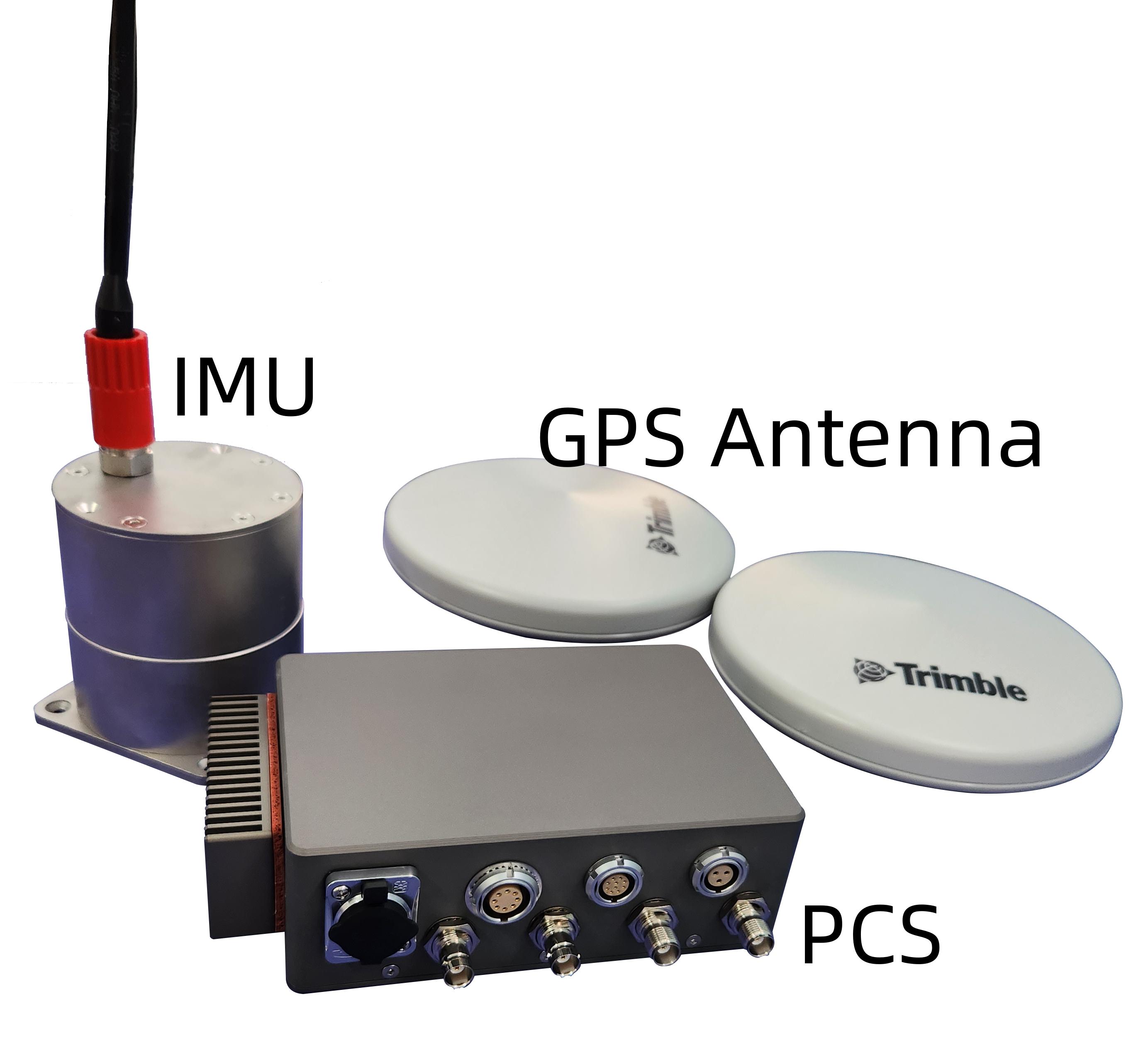
The MINS series is an in-house developed inertial navigation system for marine vessels. The system provides accurate navigation and attitude data for onboard equipment (e.g. multibeam sonar) to correct for the effects of vessel motion during survey operations. The OPT MINS provides accurate and comprehensive data sets including position (latitude, longitude and altitude), heading, attitude, heave, speed, acceleration, angular rate, performance metrics and fault detection and reporting.
MINS can fuse the angular velocity and acceleration data obtained by the IMU, the heading data obtained by the GPS GAMS and the GNSS data to provide accurate and stable position and direction information in all six degrees of freedom.
There are three models in the MINS series:
• MINS 40
• MINS 20
• MINS 18
The 18 is an entry-level model suitable for small unmanned or manned boats, and can provide roll and pitch accuracy of 0.03 degrees. The 20 and 40 are suitable for projects with higher measurement standards.
3. Installation
The truss of HydroFrog 25 is equipped with a lifting fin, and the upper base of the lifting fin is used to install the OPT MINS PCS and dual GPS antenna, and the lower mounting base of the lifting fin is used to install the Edgetech 6205s2 Combined Bathymetry & Side Scan Sonar.
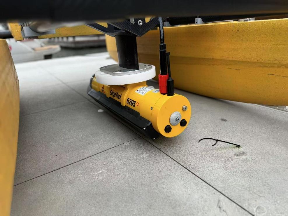
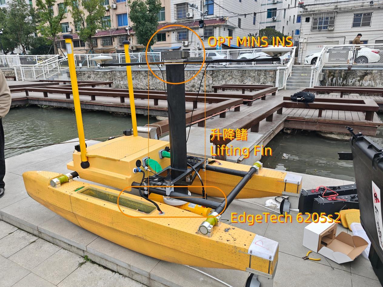
Diagram of the Installation
4. Demonstration
USV under operation
On the morning of 9 January, the demonstration area was reached, and the system was installed, the corresponding cables were connected, and a power-on test was performed. The HydroFrog 25 USV functioned normally, the OPT MINS signal output was normal, and the Egtech 6205s2 functioned normally. The survey was carried out along the river at 13:00 in the afternoon.
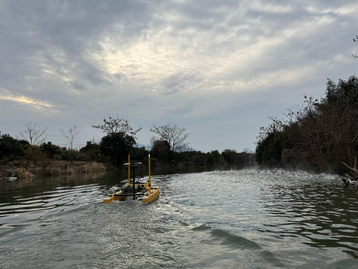
After the test preparations were completed, the equipment demonstration started at 12:40 on January 9. The USV sailed at a speed of 1-2m/s in the direction of the survey line. After setting up the software debugging, the distribution of riverbed obstacles could be clearly seen.
5. Survey Data Examples
5.1 Side Scan Data Examples
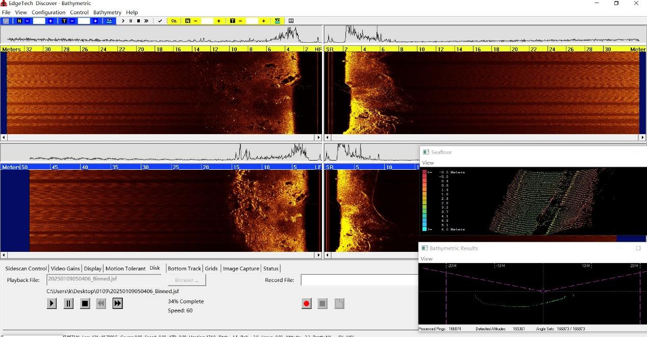
Suspected Shipwreck
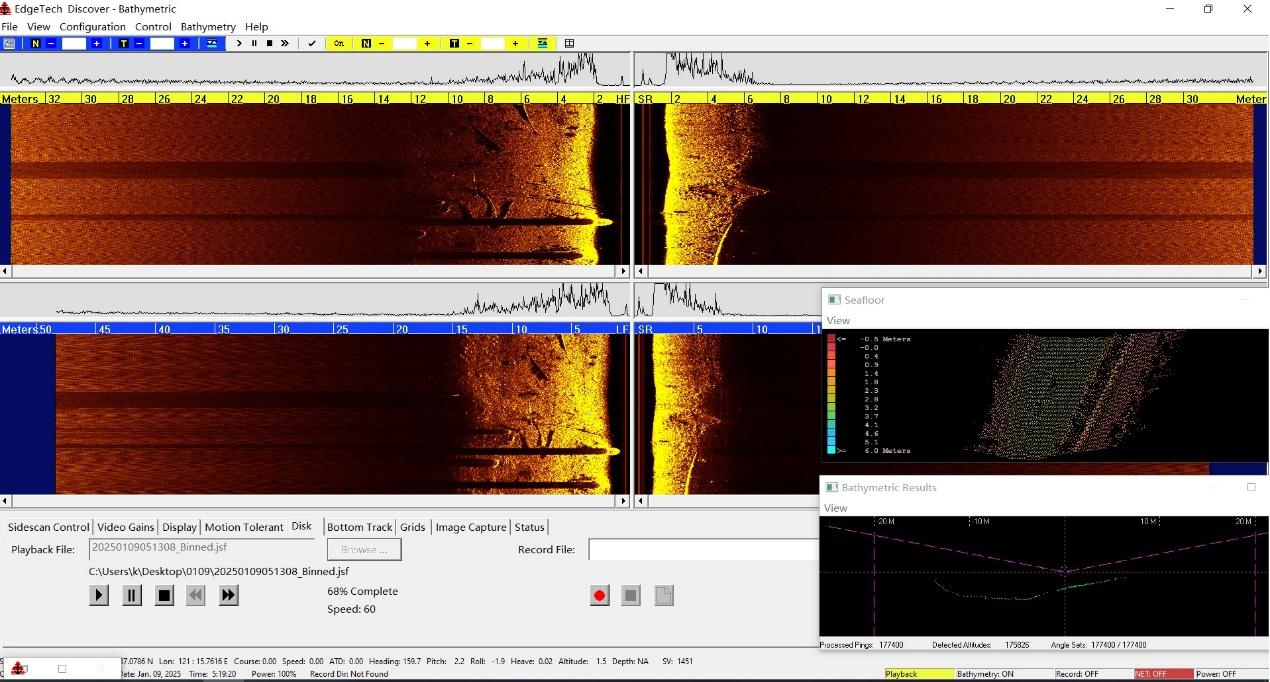
Tree branches and piles along the shore
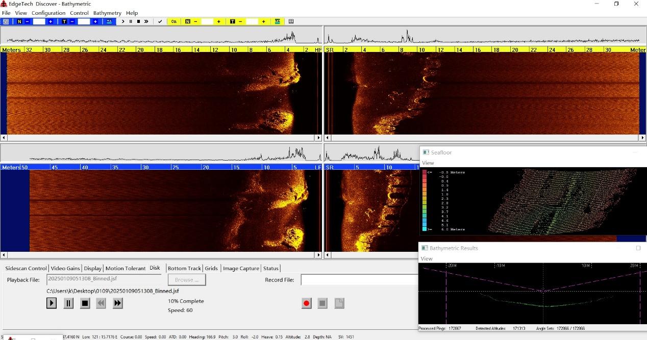
Rubble
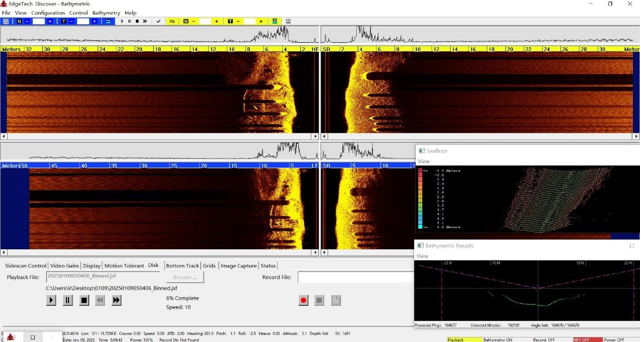
Piers
5.2 Multibeam Data Examples
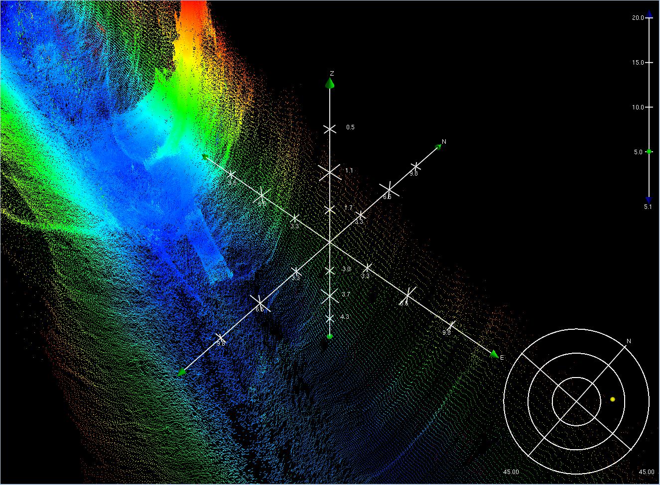
Square Structure Obstacle
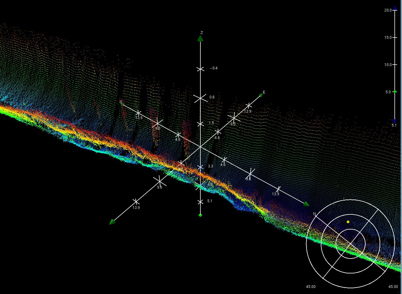

Piers
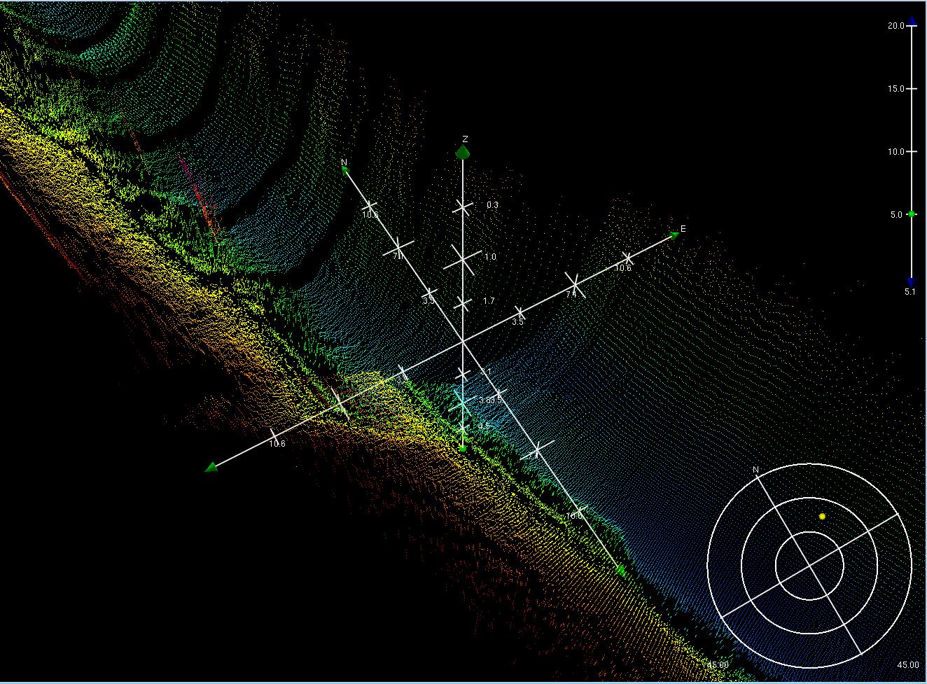
Suspected Shipwreck
6. Summary
The HydroFrog 25 USV: The payload of HF25 is 45kg. During this survey, it is equipped with Edgetech 6205s2 sonar, the weight of which is 14kg and draft is 32cm. The HF25 was surveying along the river at 1-2m/s. The hull did not have obvious bowing, and the attitude of the hull is stable during speed changes and turns.
The OPT MINS INS: The system outputs attitude, position, compass, time, PPS and other signals to the Edgetech 6205s2. The fusion of inertial navigation data and multibeam data is good, and the round-trip data has high accuracy.
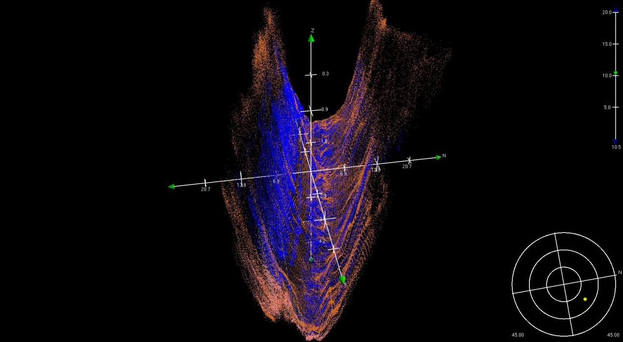
The Edgetech 6205s2: The Edgetech 6205s2 Combined Bathymetry & Side Scan Sonar can obtain a large swath width and high resolution when surveying in shallow rivers. A single survey can complete the scanning of the entire river, which is more efficient.

