Subsea Pipeline Survey using USV with Integrated Parametric SBP and MBES
2024-04-27
一. Project Overview
This project is a subsea pipeline survey in a sea area of Qingdao, the total length of subsea pipeline is 12km, the diameter of pipeline is 900mm, the average depth of water is about 10m, the burial depth of pipeline is about 1.5m.
Affected by the geological conditions and sea conditions and other disturbing factors in this sea area, the seabed scouring, the pipeline overhanging, shifting, and the external force and other potential risks are larger. Therefore, during the operation of the pipeline, in order to ensure the safety of subsea pipeline operation, the external inspection of the pipelines should be carried out regularly, so that the problems are found to be treated in time, and the report on the inspection and treatment is filed, which provides a comparative basis for the future inspection and analysis, and grasps the operating condition of the pipelines more comprehensively to ensure the safe operation of the subsea pipelines.
This time, the unmanned surface vessel HydroFrog 25, a self-developed product of Ocean Physics Technology, is equipped with GeoScope 100 parametric subbottom profiler and HQ-400 multibeam echosounder to carry out pipeline inspection and hydrographic survey. GS-100 parametric SBP is used to obtain the pipeline's location and burial depth information, and HQ-400 multibeam echosounder is used to obtain the pipeline peripheral topographic information to achieve the monitoring of scouring and siltation of pipeline areas. The HQ-400 multibeam echosounder obtains the topographic information around the pipeline, so as to monitor the scour and siltation in the area where the pipeline is located and ensure the safe operation of submarine pipelines.
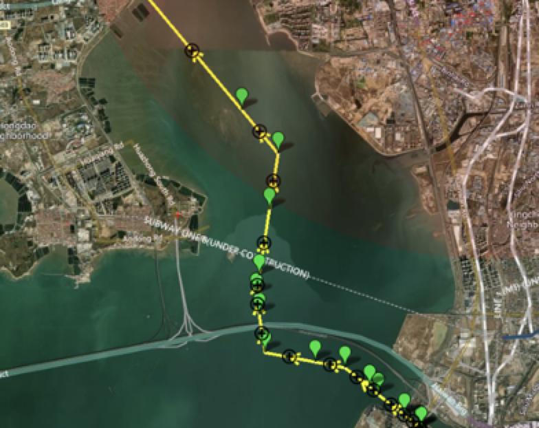
Fig. 1 The pipeline routine to be inspected
二. Survey Solution
This survey area is at the junction of land and sea, water depth: 1-6m, shallow water depth, due to the water depth limitation, manned vessel operation is difficult. After preliminary communication, it was decided to use USV carrying acoustic system for the survey, the advantage of which is that USV solution is flexible in operation, has a strong carrying capacity, has a longer range and meets the operational requirements.
2.1 HydroFrog 25 USV
The HydroFrog 25 is a catamaran with more stable roll, 2.5m in length and 1.3m in width, with an open truss in the centre, which allows it to carry a variety of types of equipment to perform different scenarios and tasks. The front and rear mounting platforms are convenient for levelling the overall weight of the unmanned vessel, with a maximum payload of 45kg and a maximum range of 5 hours at 4-5 knots.
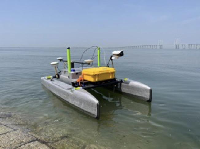
Fig 2. HydroFrog 25 USV
2.2 GeoScope 100 Parametric SBP
The GS-100 is a parametric subbottom profiler with differential frequency 5-20kHz, maximum penetration depth 40 metres, differential frequency source level greater than 194 dB/uPa @ 1m@10 kHz, transducer weight 8Kg, deck unit compact, suitable for USV integration operations.
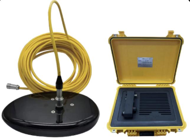
Fig. 3 GS-100 SBP
2.3 HQ-400 Multibeam Echosounder
HQ-400 is a newly released 3D echosounder system that combines compactness, portability and versatility, with a transducer weight of 2.7kg and a deck unit size of 12.5cm*12.5cm*4.2cm, which is small in size, light in weight, and low in power consumption, with built-in attitude, positioning, and speed of sound, and is free of calibration and debugging, and can be operated when switched on and is deeply integrated with the USV platform.
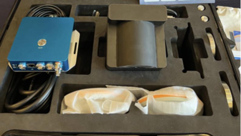
Fig.4 HQ-400 Multibeam Echosounder
三. Survey Process
3.1 Setup of the two system
The overall assembly and commissioning of the HF25 USV was completed on shore, with the GS-100 SBP transducer and the HQ-400 MBES transducer installed on the lifting fins of the USV, and the deck unit installed on the bow mounting platform and in the cabin and the relevant wiring and commissioning work completed.
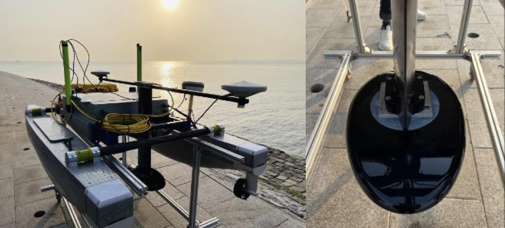
Fig.5 HF 25 USV with GS-100 SBP
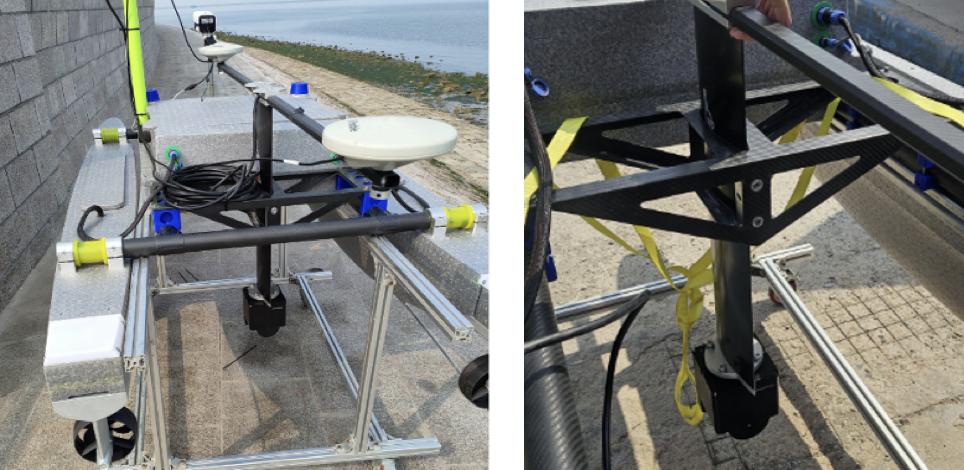
Fig.6 HF 25 USV with HQ-400 MBES
3.2 Pre-survey Testing
Place the USV in the water, turn on the power, test the USV radio communication is normal, SBP and MBES can work normally.
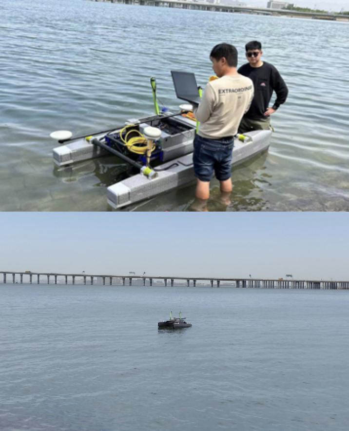
Fig. 7 Testing the USV in water
3.3 Data Acquisition
3.3.1 Route Planning
According to the pipeline routing information provided by Party A, the survey line is laid in the control software of the unmanned vessel. The USV cruises along the measurement line automatically at 4 knots. The surveyor adjusted the parameters of the carrying equipment at the display terminal of the shore station, records the data, and monitors the status of the USV and the carrying equipment in real time through the display terminal of the shore station.
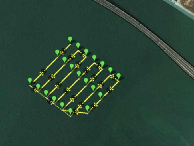
Fig.8 USV Route Planning
3.3.2 SBP Data Acquisition
The survey line was conducted across the pipeline with a speed of 4 knots. SBP is using a 12kHz Continuous Wave. A total of seven survey lines were tested, all of which were able to locate the pipeline, with some of the pipeline being exposed.
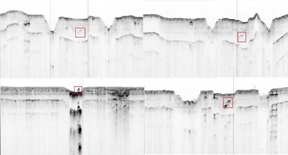
Fig. 9 GS-100 SBP data in real time
3.3.3 MBES Data Acquisition
The HQ-400 was using a 120° coverage, which is better for noise suppression in the shallow water area. The multibeam adopts the built-in IMU, which is easy to install and free of calibration. The HF 25 USV has a stable operation motion and the tail current is small when switching the survey line, which has almost no effect on the data quality.
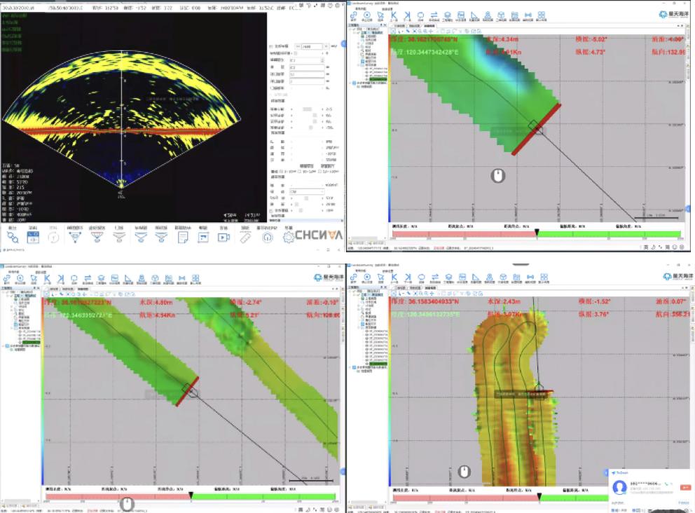
Fig. 10 HQ-400 MBES data in real time
四. Data Exampes after post-processing
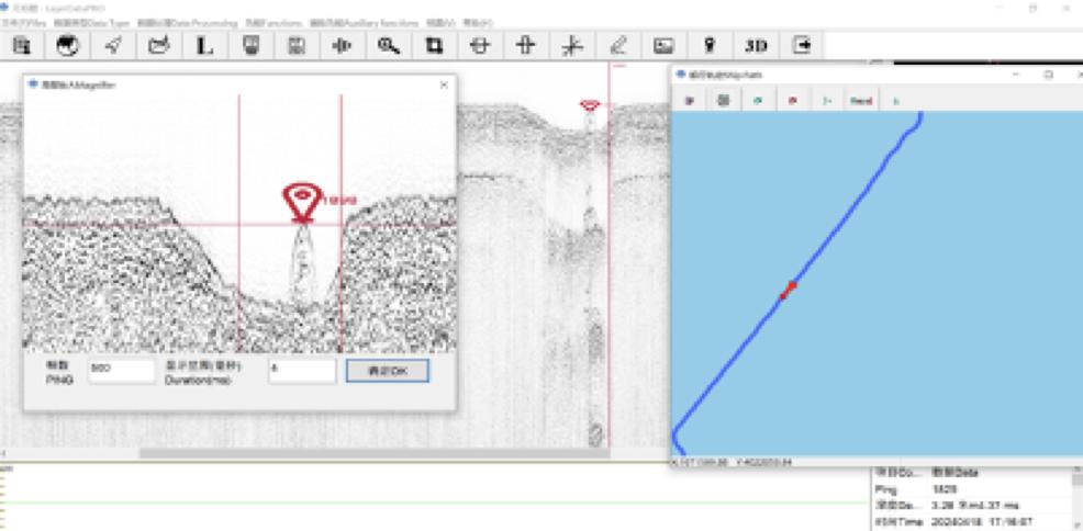
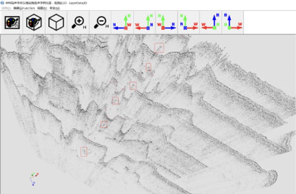
4.1 SBP Data Examples
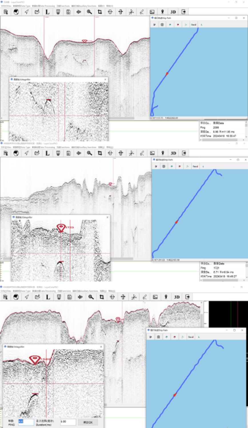
4.2 MBES Data Examples
