Siltation Measurement in Lake Taihu by GeoScope
2023-03-01
Products:GeoScope 100 Surface、GeoScope200 Submersible
Date:Early 2023
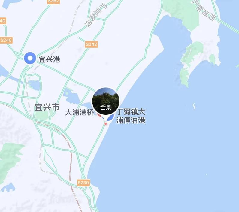
Location:Taihu Lake, Yixing section, near Dapu Harbour
Demonstration Purpose:
In early 2023, Ocean Physics Technology Ltd. organised a Geo Scope Parametric Subbottom Profiler system test demonstration in the Yixing section of Lake Taihu, with the main objective of verifying the Geo Scope's capability of detecting the silt thickness in the Taihu Lake basin.
Demonstration Area:
Near Dapu harbour in the Yixing section of Taihu Lake. The water depth in its test area ranged from 2.5 metres to 4.5 metres.
Products:
This demonstration uses GeoScope series GS-100 Surface and GS-200 Submersible SBP system. GS-100 Surface SBP mainly includes 220V to 24V power adapter, network cable, ground cable, deck unit, transmitting & receiving transducer, SPAS acquisition and display software. GS-200 Submersible SBP mainly includes 220V to 24V power adapter, network cable, ground cable, transmitting & receiving transducer, communication and power cable, SPAS acquisition and display software.
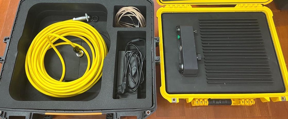
GS-100 Surface
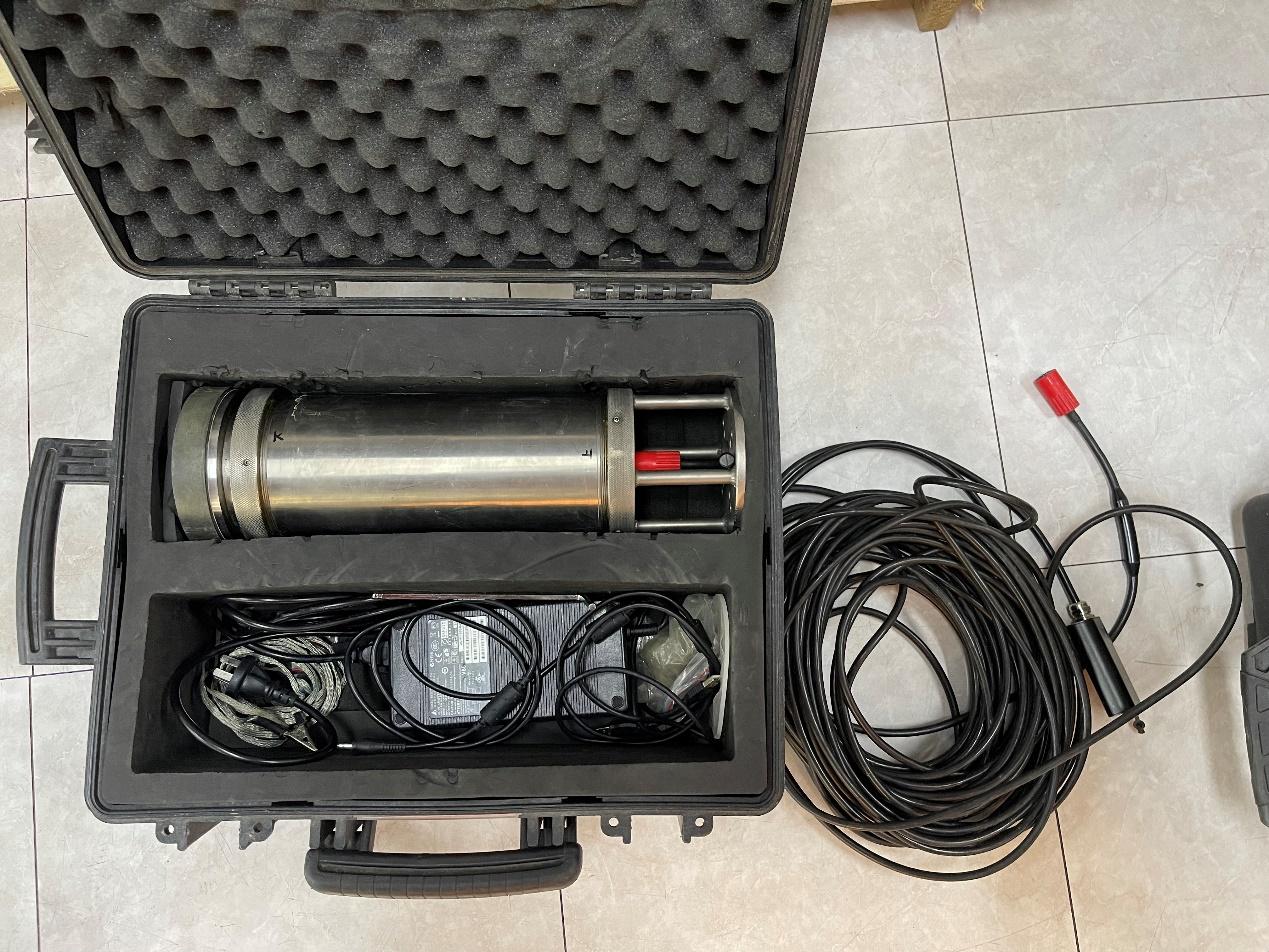
GS-200 Submersible
Installation:
The GeoScope series is mounted in a fixed bracket, flanged to the mounting bracket, which is fixed to the side of the vessel and reinforced by three cables: bow, stern and bilge.
The GPS antenna is mounted above the cockpit in the open area of the rodeo deck, and the acquisition and post-processing system is located in the cockpit.
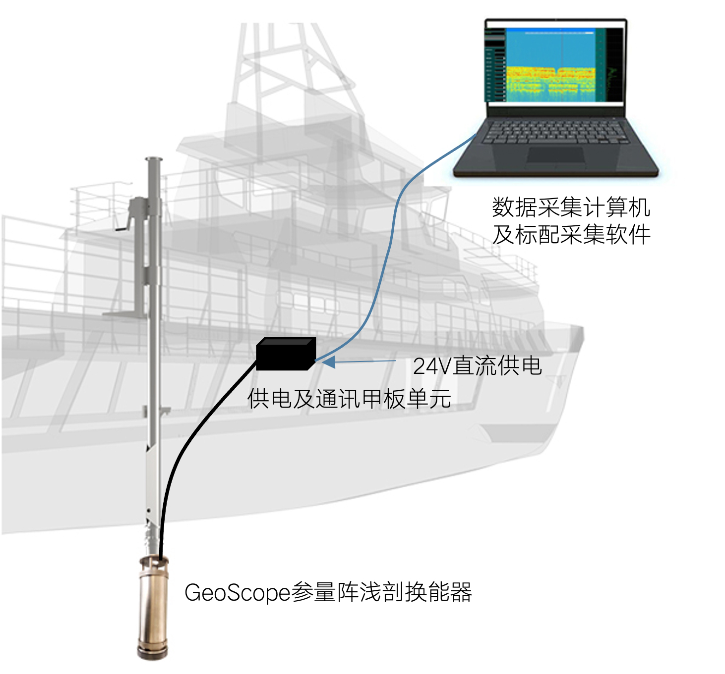
Installation Schematic 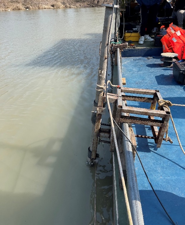
Installation At Site
Preparation for the demo:
Arrived at the demo area and the unit was completed with side mounting, system connections and power-up testing.
Demo Process:
After the test preparations were completed, the equipment demonstration work began. The boat travelled along the direction of the test line at a fixed speed. After software settting-up, gain and other settings, the river bottom can be clearly seen.
Data Examples:
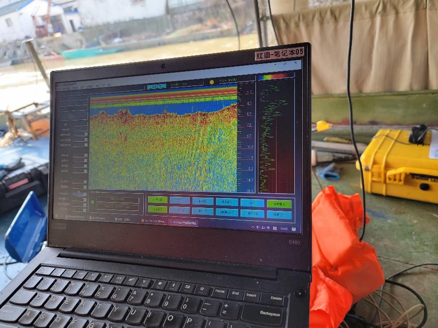
SPAS Acqusition Software User Interface at site


GS-100 Data Example 1
As can be seen from the above figure, the green line is the interface of the weathering layer, which is very obvious, and above the green line, it can be judged as a soft mud with high water content, whose acoustic reflection is very weak, which can be interpreted as "silt".


GS-100 Data Example 2


GS-100 Data Example 3
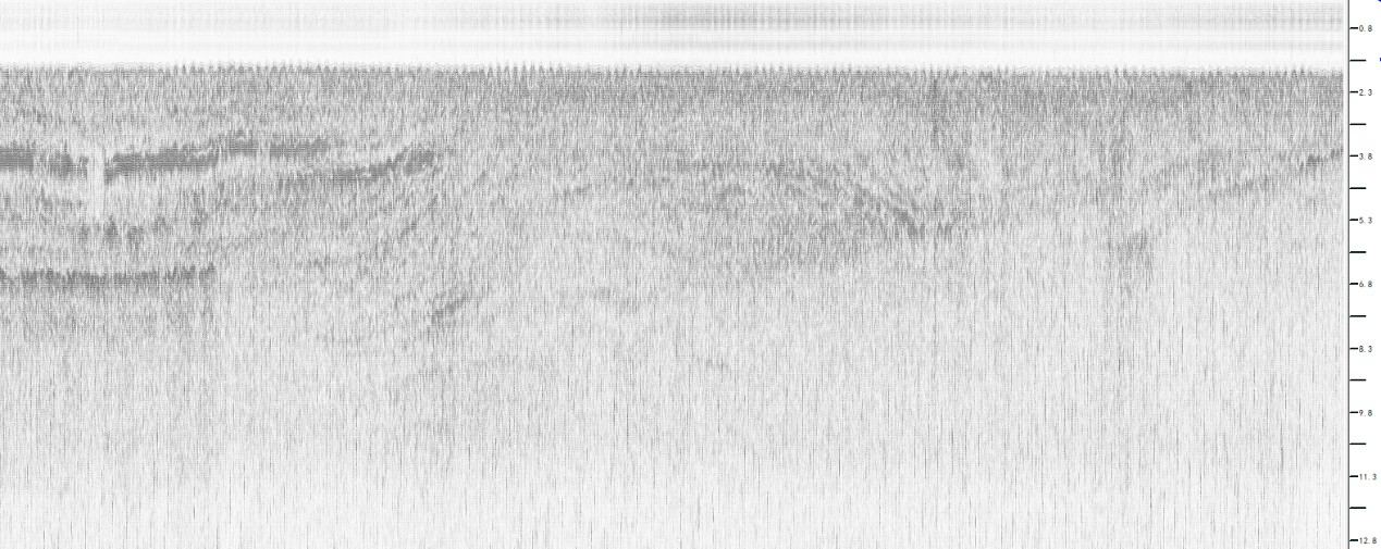
GS-200 Data Example 1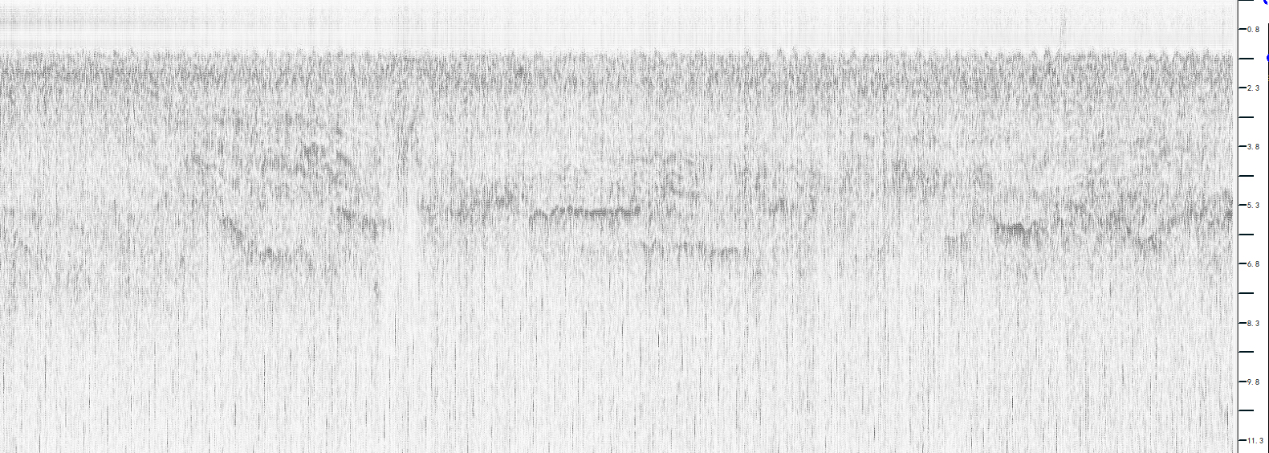
GS-200 Data Example 2
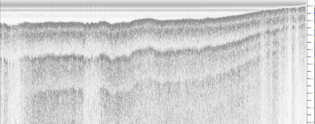
GS-200 Data Example 3
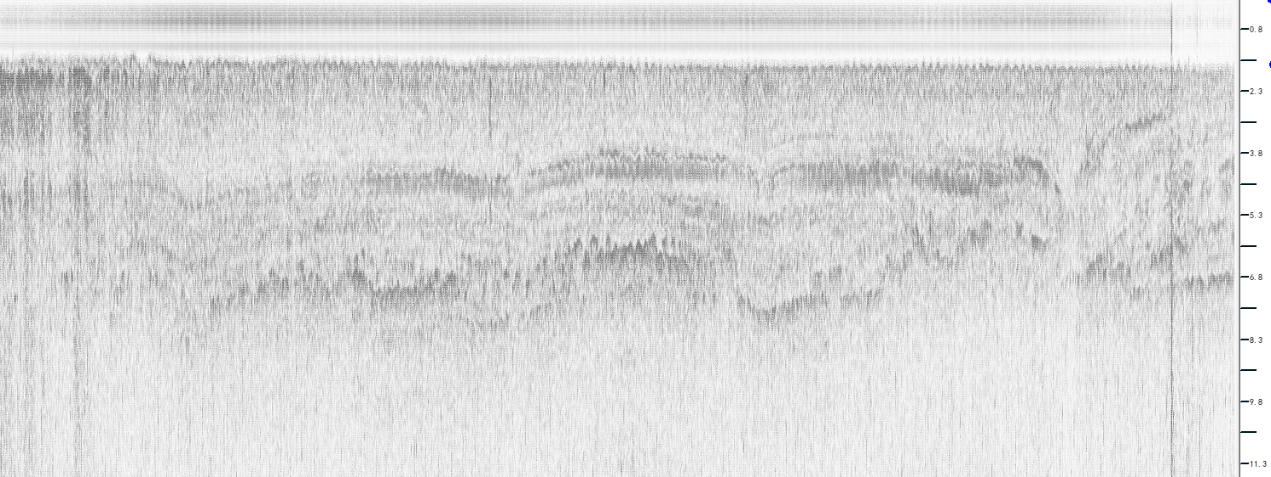
GS-200 Data Example 4

GS-200 Data Example 5
Summary:
GeoScope series parametric SBP is based on the principle of nonlinear acoustics, using two high frequencies to generate differential frequency, to ensure a high rate of separation while obtaining a large depth of penetration, which allows detailed detection of the structural state of small targets on the seabed. The transducer is small in size, which is convenient for deployment and operation.
The demonstration sweep in Lake Taihu this time, the echo image stratification is obvious, can intuitively obtain the depth of the sedimentary layer, through the field measurement of the lake bottom data, and the actual topography described by the situation is generally consistent with the topography.
Suggestion:
This demonstration shows the GS-100 SBP and GS-200 SBP, due to the aging of the equipment the GS-200 did not achieve the best results. Secondly, the noise generated by the ship will also interfere with the equipment. Therefore, when installing the transducer, the depth of the transducer into the water should be more than the draft of the ship to avoid the beam being blocked by the hull of the ship, and at the same time, the transducer installation position should be far away from the ship's engine to avoid noise interference. In addition, the ship's speed should be adjusted to control the vibration noise of the ship.

