Pipeline Survey in Liaoning by GeoScope 100
2022-08-08
Products:GeoScope 100 Surface
Date:July, 2022
Location:A sea area in Liaoning province
Water Depth:30-35 m
Detection target: 200mm-600mm diameter submarine pipeline of various specifications
Project difficulties:
1. high organic matter content and gas content of seawater on site, very serious noise in the water column
2. flat hard chalky substrate with strong reflections, resulting in poor bottom penetration

In order to reduce the impact of surface noise, the transducer is mounted with a draft of about 1.5 metres and the mounting bar is tilted back about 5 degrees, resulting in a weak front and strong back of the sea tube image around the shooting arc.
Data Examples:

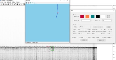

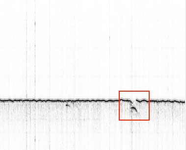
Raw data vs. post-processed data:
Point 1
We also found during post-processing that the field data did not look for the target pipeline, while the post-processed data presented better.

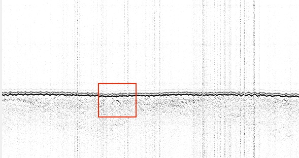
Upper panel: real-time acquisition data, lower panel: post-processing imaging with the presence of a wrap-around arc
Point 2:
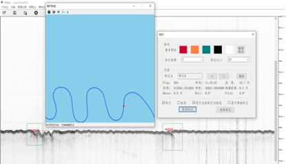
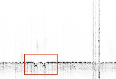
The raw data of the above points are shown in the above figure, with shallow burial depth, and the coordinates and burial depth are shown in the software statistics.
Post-processing can clearly display the pipeline target as shown below:
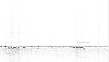
Unknown Pipeline Type
Point 3:
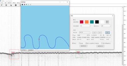
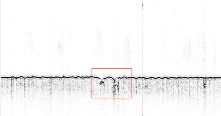
The raw data of the above points are shown in the above figure, with shallow burial depth, and the coordinates and burial depth are shown in the software statistics.
Post-processing can clearly display the pipeline target as shown below:
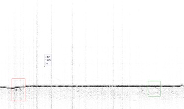
Unknown Pipeline Type
Point 4:

The raw data of the above points are shown in the above figure, with shallow burial depth, and the coordinates and burial depth are shown in the software statistics.
Post-processing can clearly display the pipeline target as shown below:
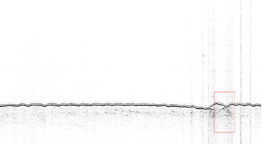
Unknown Pipeline Type
Project Summary:
The water body in this area is noisy and has a fine powdery sand substrate, which greatly affects the penetration.
GeoScope 100 used Chirp mode in this sea trial, the field data is not as clear as CW, but avoided more water body noise.
Record of the class report of the Ocean Circle's renowned traditional craftsmen:
Departed harbour at 0640.
0910 arrived at the survey area, sunny to less cloudy, light fog, southerly wind 4~5, quasi-class II sea state, water depth 30m~35m in the survey area.
0920Equipment installed, transducer draft 1.0m, start operation.
0935 Noise on the surface, increase transducer draft to 1.5m.
*. Installation pole tilted back about 5°, resulting in the sea tube image around the shooting arc before weak and then strong
1100 Wind gradually increased, sea state rose to Class II.
1140 End of operation
*. During this period, various sizes of submarine pipelines ranging from 200mm to 600mm and cable routes ranging from 100mm to 150mm were detected, usually in a "one cable, two pipelines" arrangement, and all the pipelines could be recognised in the original image, but not the cables.
Personal feelings:
1. This set of equipment in the use of feeling is still quite good, friendly interface, easy to operate, get started quickly, like I have not used the amateur boot half an hour later can also be tinkered with a seven or eight, for the submarine pipe and cable detection, the three modes of personal prefer the first one;
2. UI and original image still feel almost interesting, of course, I mainly from the geological, geophysical point of view to assess the image, it feels like seeing a woman, quite beautiful, but not sexy ......
3. Physical structure aspects still need to be optimised and improved, such as the weak connectors of the probe and the lack of necessary impact protection, the possible bamming of the panel when the deck unit is placed upside down may cause the crimping strips to fall off, and so on.

